
VU.CITY and Verified Views in Urban Planning Practice
Introduction
Digital modelling technologies are reshaping how we approach urban planning and design decisions. VU.CITY represents a significant development in this space, providing interactive 3D city models to support design evaluation and stakeholder engagement. However, understanding when this technology excels and when more rigorous visual methods become necessary is crucial for effective planning practice. NPA Visuals often see VU.CITY used for early-stage viewpoint exploration before Verified Views are requested to further test a shortlist of viewpoints for formal assessment work.
The following article explores which visualisation method best serves different stages of the planning process.
VU.CITY’s Strengths in Early Planning
VU.CITY functions as a 3D digital modelling platform supporting urban design, architecture, and development across major cities. The platform currently includes full-coverage models of over 25 UK and international cities, with London modelled across 1,600 km² at 15-centimetre accuracy.
Architects, developers, and planning consultants use VU.CITY to import proposed designs and visualise them within a basic 3d urban context. The platform enables collaborative working between project teams, facilitating early-stage testing of massing options and basic shadow analysis. For planning teams, this means identifying potential conflicts with regulations or local character before detailed design development begins.
The platform’s collaborative features support transparent stakeholder engagement. Multiple users can access the same digital environment, reducing miscommunication during design development phases. For public consultation preparation, VU.CITY helps teams understand which viewpoints might generate community concern, allowing proactive design refinement.
Understanding VU.CITY’s Visual Limitations
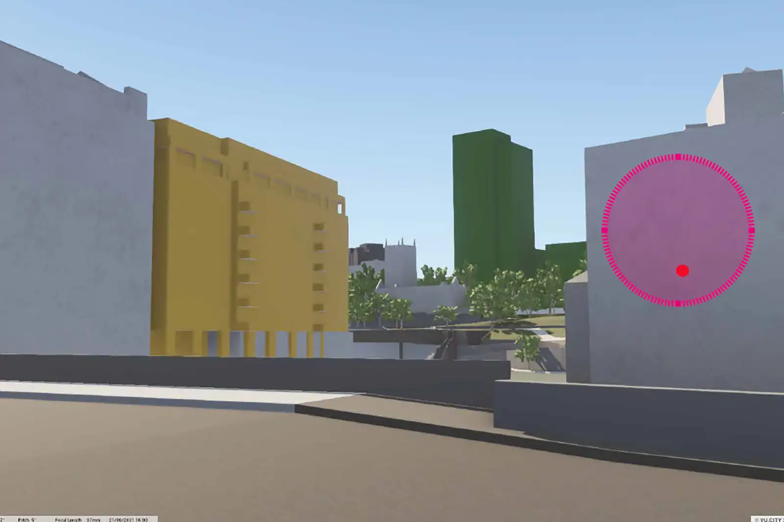
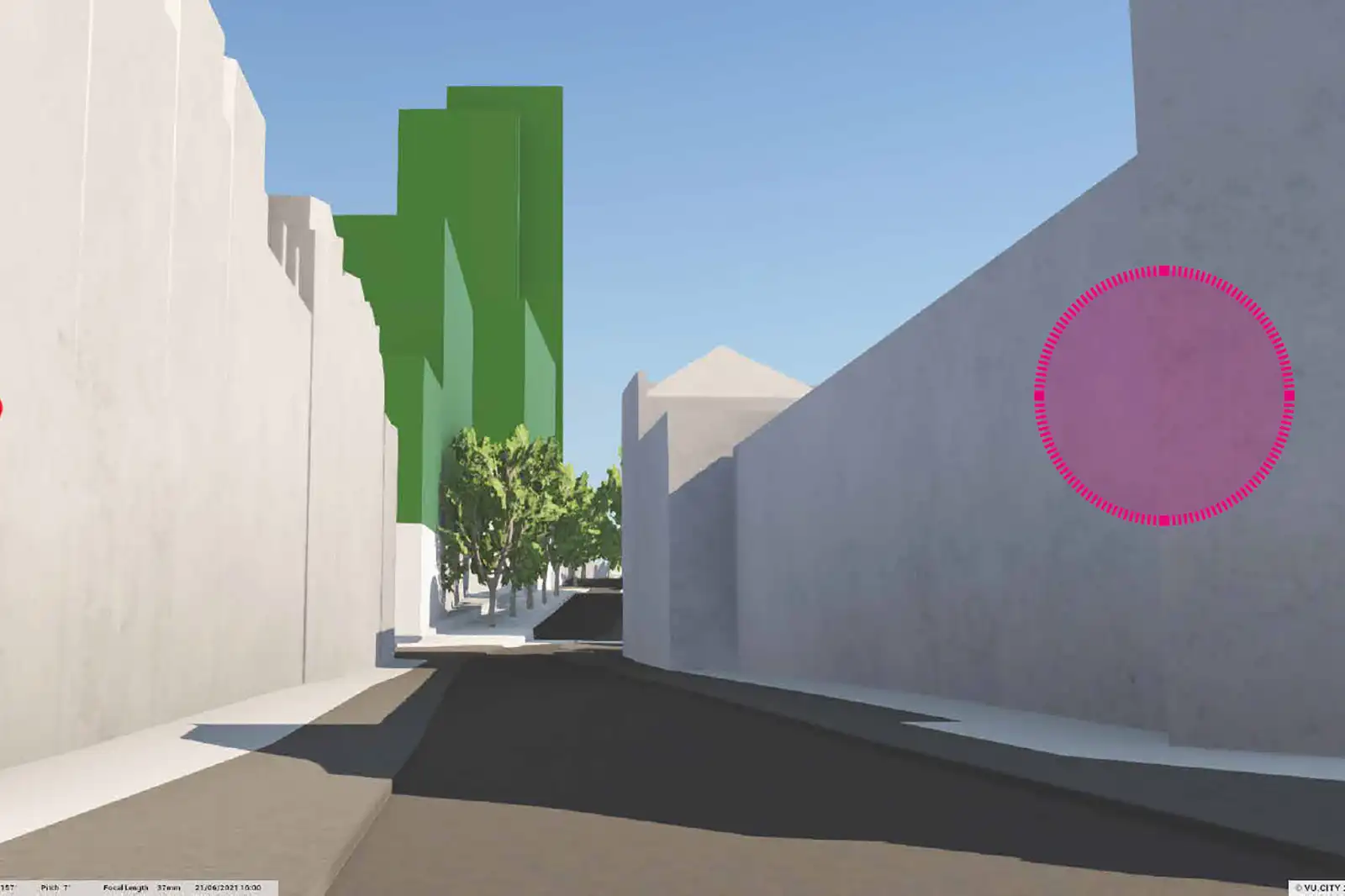
Whilst VU.CITY excels in contextual analysis, its visual representation carries limitations that professionals must be aware of. Many buildings appear as simplified geometric forms rather than detailed architectural elements. Street-level detail – including shopfronts, signage, vegetation, and human activity – remains absent from most models.
The platform’s lighting simulation, whilst useful for basic shadow studies, lacks the photorealistic quality needed for accurate visual impact assessment. Computer-generated shadows and reflections don’t capture the atmospheric conditions, seasonal variations, or material interactions that influence how developments actually appear in the real world.
Camera positioning flexibility within VU.CITY, whilst valuable for exploration, can inadvertently create misleading perspectives. Wide-angle distortion or inaccessible viewpoints might minimise visual impact, particularly for tall buildings where scale perception varies significantly with viewing angle and distance.
When Verified Views Become Essential
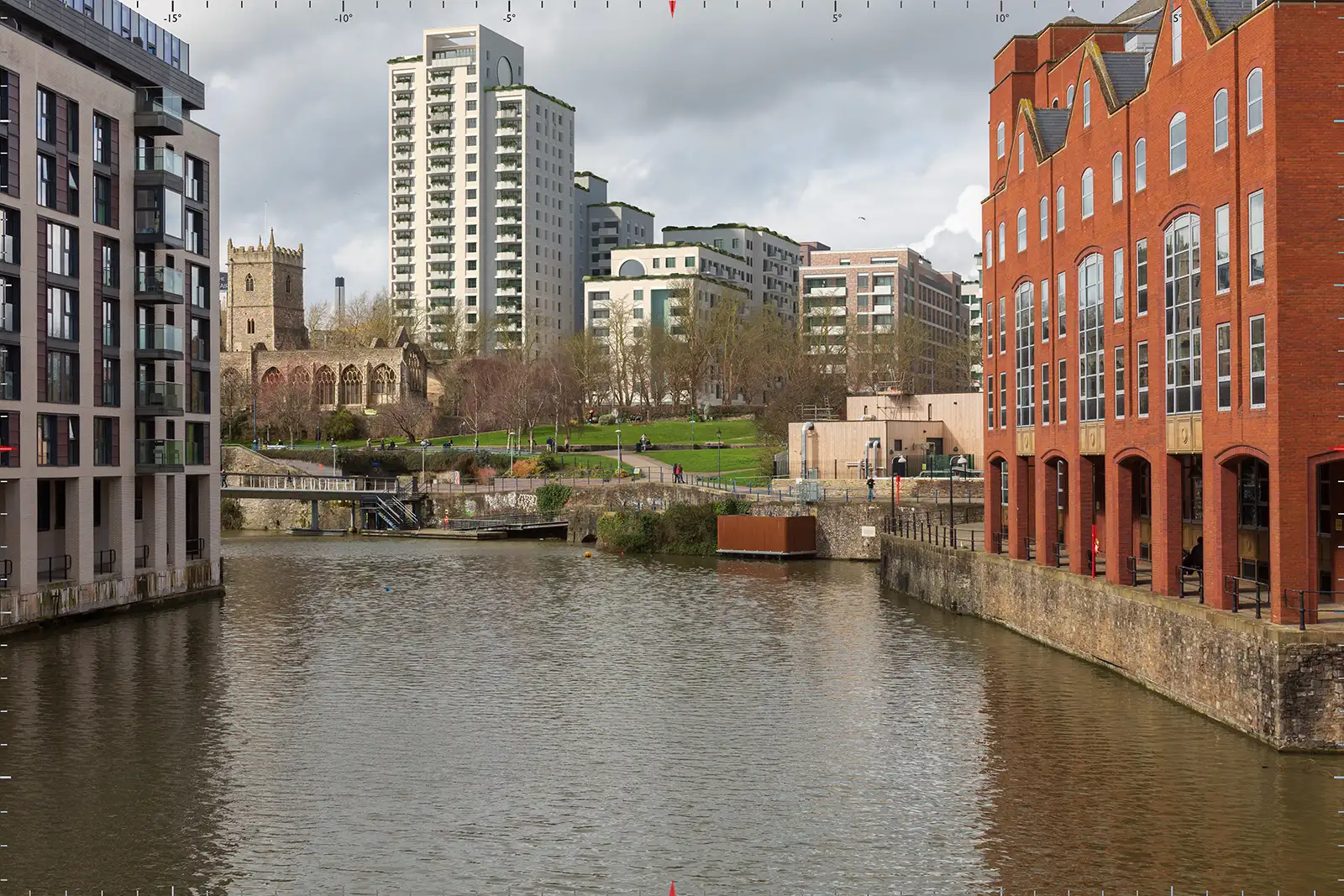
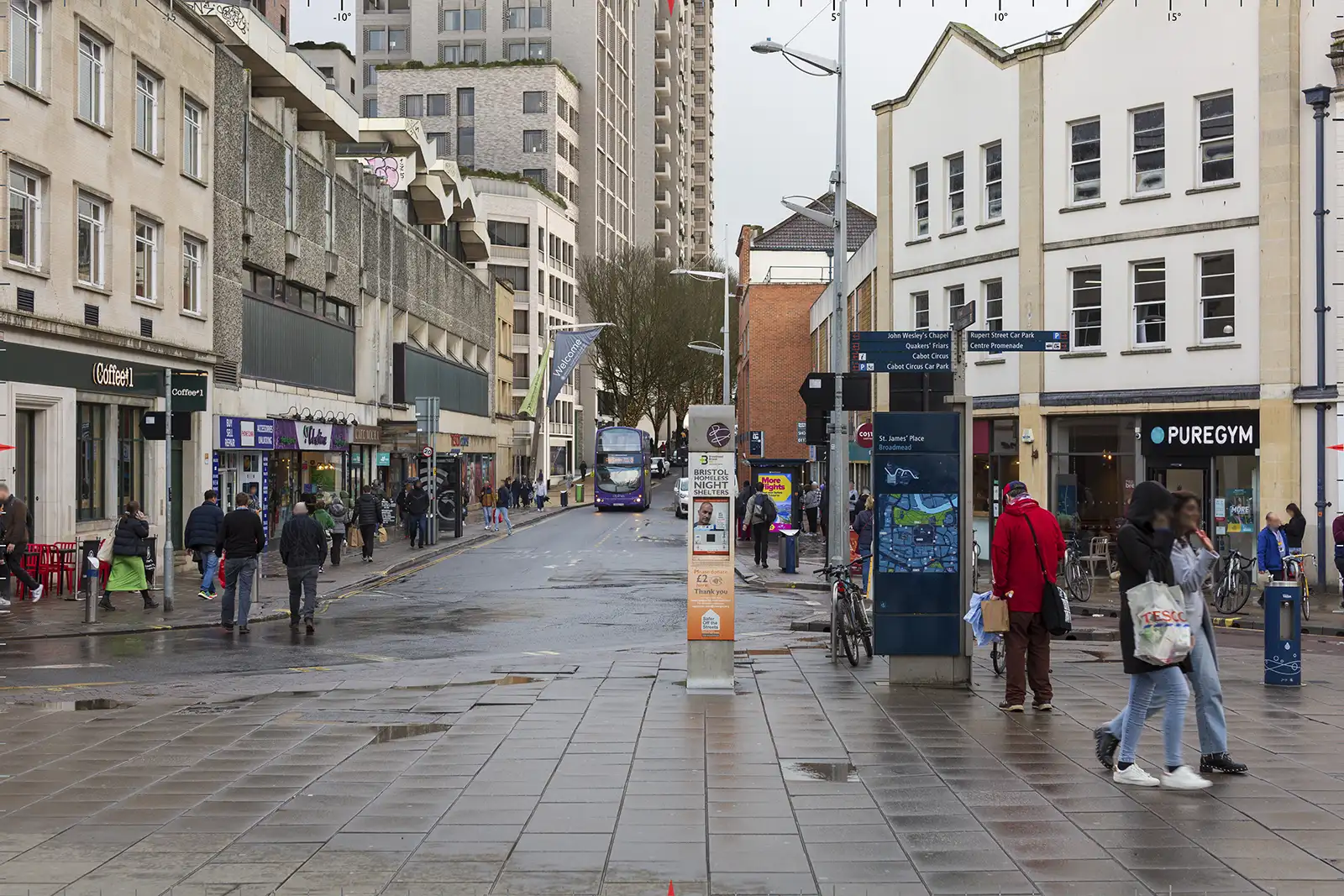
Verified Views compliment VU.CITY by providing greater photographic accuracy and a standardised technical methodology. These Accurate Visual Representations use high-resolution photographs taken from precisely surveyed camera positions, offering eye-level perspectives that reflect real human experience. The technical methodology involves measured survey data including GPS coordinates, camera height, and lens specifications. 3D software aligns proposed development models to exact photographic positions, with alignment accuracy audited against industry standards such as the London View Management Framework or Landscape Institute guidance.
This process eliminates perspective manipulation whilst delivering architectural detail that VU.CITY cannot match. Verified Views include façade treatments, realistic materials, lighting conditions, and seasonal vegetation. They can demonstrate time-of-day variations, seasonal change, and atmospheric effects that influence actual visual impact.
Complementary Applications in Practice
Professional planning teams increasingly recognise these technologies as complementary rather than competing approaches. VU.CITY serves early-stage design development, enabling rapid iteration and stakeholder alignment before detailed visualisation investment. Its strength lies in contextual understanding and collaborative exploration.
Verified Views become essential when visual accuracy influences formal decision-making. Planning committee presentations, heritage impact assessments, townscape and visual impact assessments, and public inquiry submissions require the standardised accuracy that only survey-based photography can deliver.
The combination allows planning teams to progress from conceptual understanding through VU.CITY to evidential documentation through Verified Views. This staged approach optimises both time investment and visual communication effectiveness throughout the planning process.
Enhanced Stakeholder Communication
Both technologies transform stakeholder communication, though in different ways. VU.CITY democratises early planning discussion by making complex urban relationships accessible to non-specialist audiences. Interactive exploration helps community groups understand contextual relationships that 2D plans cannot convey.
Verified Views build public trust through transparent methodology and peer-reviewable accuracy. When planning decisions require formal justification, stakeholders can scrutinise verified view methodology independently. This transparency reduces objections based on mistrust whilst providing clear evidence for informed decision-making.
Conclusion
VU.CITY and Verified Views serve distinct but complementary roles in contemporary planning practice. VU.CITY provides contextual understanding and collaborative exploration capabilities that transform early-stage planning discussion. Verified Views deliver the photorealistic accuracy and methodological rigour essential for formal assessment and public accountability.
Effective planning visualisation combines both approaches strategically throughout project development. Understanding each technology’s strengths and limitations enables planning professionals to communicate more effectively with stakeholders whilst maintaining the visual accuracy that planning decisions require. The future of planning visualisation lies not in choosing between these technologies but in applying them appropriately to deliver both collaborative exploration and evidential accuracy.
(VU City Images curtesy of AHMM Architects)
Please contact us to discuss how our visualisation team can help you with your next project.