

Verified Views
Accurate Visual Representations
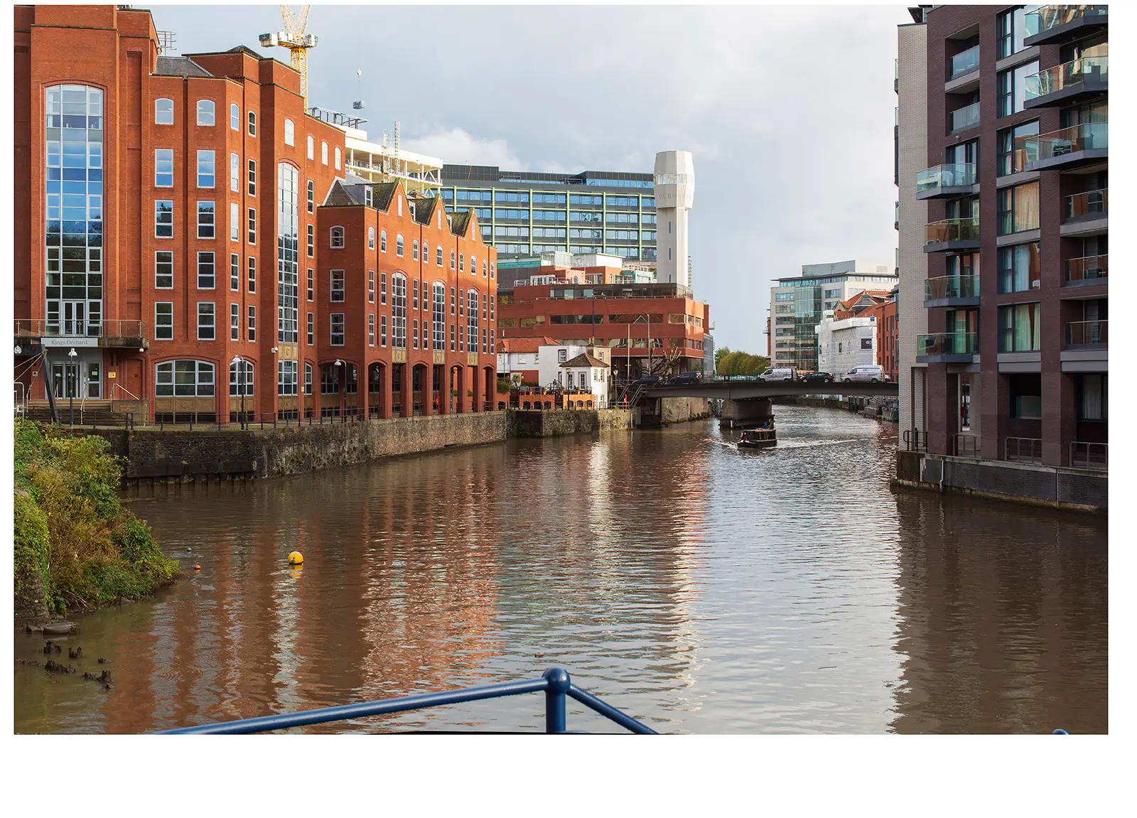
Our Verified Views provide accurate and precise representations of proposed developments in-situ.
At NPA Visuals, we craft accurate Verified Views by combining CAD-rendered 3D models of proposed schemes with our verified photographic data.
Also referred to as Verified View Montages (VVMs) or Accurate Visual Representations (AVRs), our visuals ensure that designs are depicted as they would be seen, in reality.
With over two decades of experience, we offer unmatched expertise in creating Verified Views, consistently assisting clients in preparing visualisations of their designs, enabling informed stakeholder engagement, and securing planning approvals.


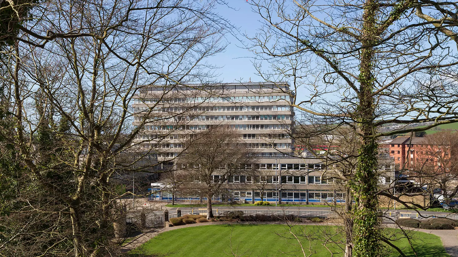
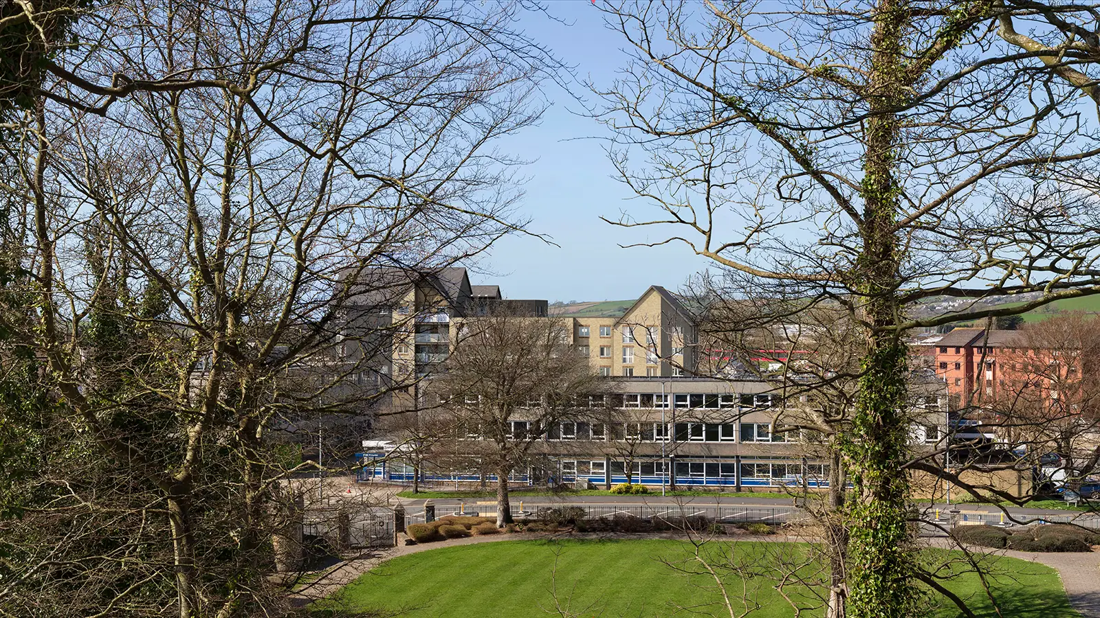
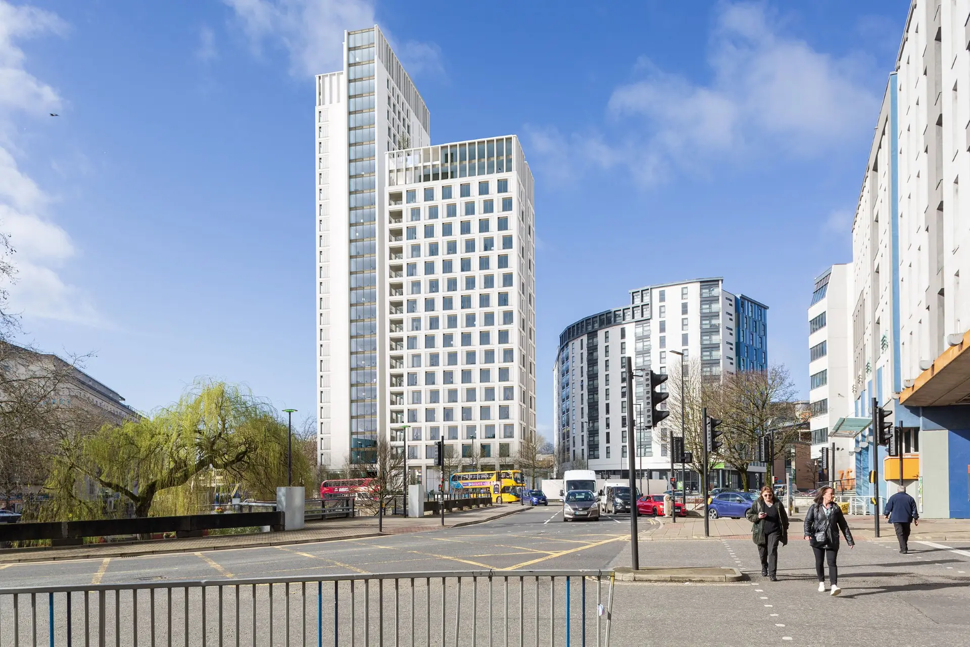
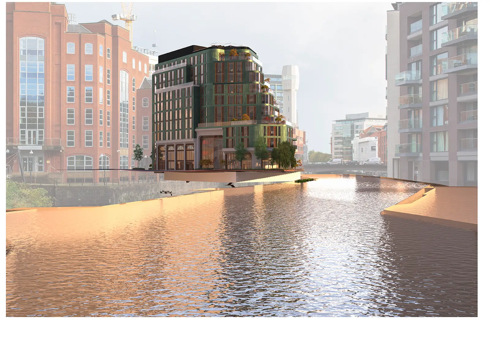
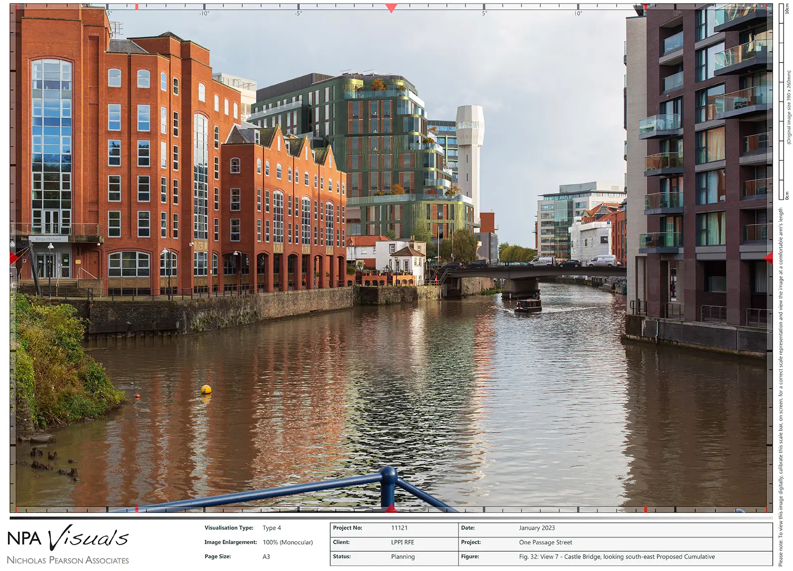
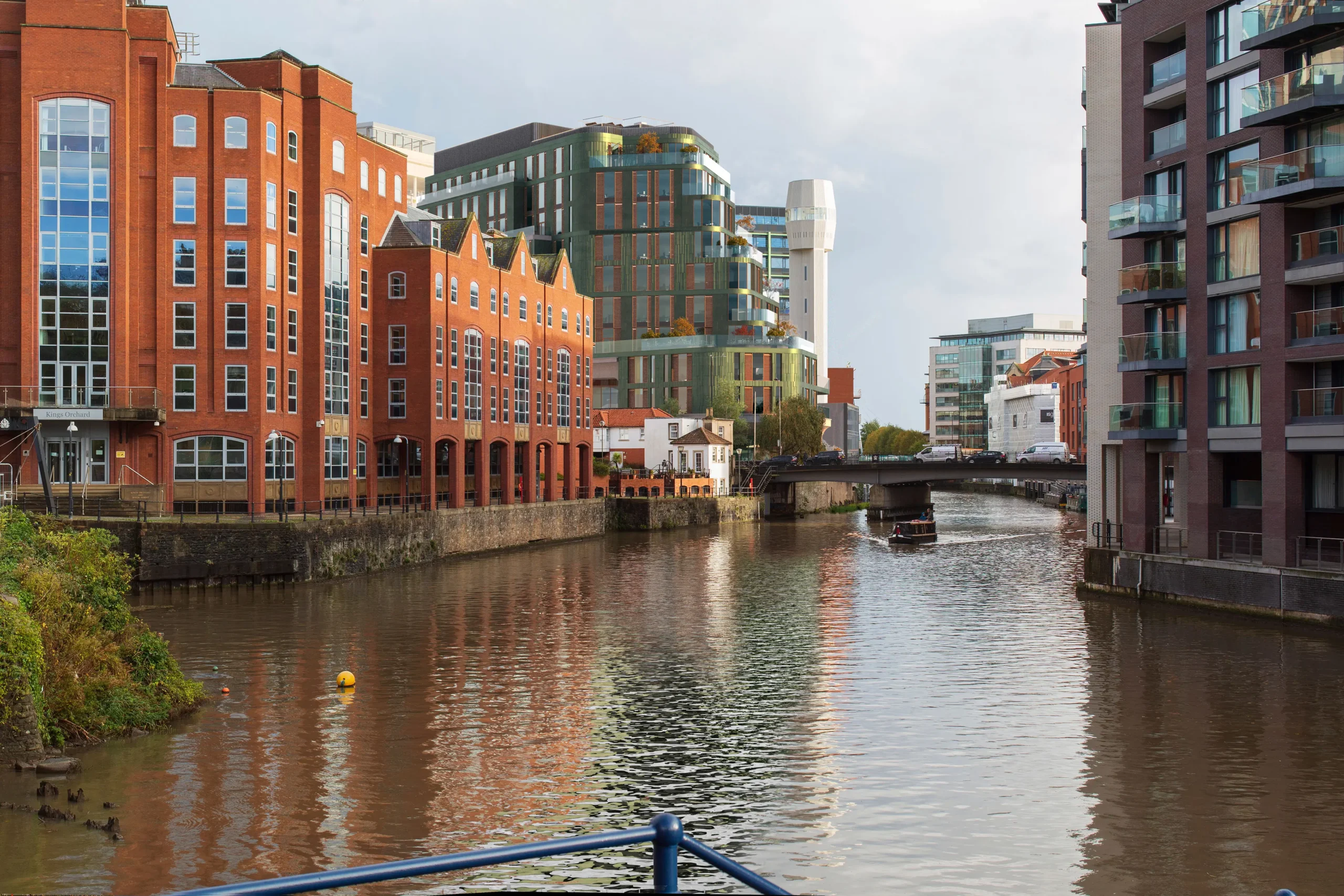
Bower Lodge Retirement Living: Existing & Proposed Verified Views Montage


Verified Views Services
Verified Views effectively visualise developments and enhance success across multiple assessment types, including Landscape and Visual Impact Assessments (LVIAs), Townscape and Visual Impact Assessments (TVIAs), Heritage Impact Assessments (HIAs), and inform Public and Planning Committees.
Our visualisations are accurate, contextually grounded, and designed to inform decisions while building stakeholder confidence.
In support of a range of planning and design needs
Our Verified Views services provide high quality support across different projects.
Verified Views provide Accurate Visual Representation (AVR) crucial for planning decisions. They bridge the gap between design concepts, technical drawings, and real-world appearance, helping stakeholders, planning authorities, and the public understand visual implications and impacts.
Our Verified Views combine photorealistic montages with site-specific data and 3D models, ensuring accuracy and comprehensive representation that meets the highest standards.

Verified Views are invaluable for Landscape or Townscape and Visual Impact Assessments (LVIA and TVIA). By integrating precise 3D design models with high-resolution photography, our visuals offer impartial representations of how proposed developments interact with surroundings, reinforcing your professional assessment of effects. These images are meticulously developed from representative viewpoints and in alignment with established guidelines.

Verified Views are invaluable for evaluating development impact on heritage assets including Conservation Areas, Listed Buildings, and World Heritage Sites. Captured from key vantage points, these visuals show how proposed designs integrate with historic settings, illustrating the balance between contemporary intervention and heritage conservation.
Verified Views are provided in formats tailored to your requirements. Our standard deliverable is a digital PDF featuring ‘existing’ and ‘proposed’ views with technical methodologies, survey data, and camera information. We also offer digital-only presentations, large-scale posters, and exhibition displays, and can advise on the most suitable format for your project needs.
Verified Views provide photorealistic montages that accurately highlight design features and attributes. This is especially valuable for projects emphasising material selection, refined aesthetics, and environmental integration. Working with design teams, we create AVRs that clearly communicate designs while portraying accurate real-world impact.
Verified Views provide Accurate Visual Representation (AVR) crucial for planning decisions. They bridge the gap between design concepts, technical drawings, and real-world appearance, helping stakeholders, planning authorities, and the public understand visual implications and impacts.
Our Verified Views combine photorealistic montages with site-specific data and 3D models, ensuring accuracy and comprehensive representation that meets the highest standards.
Verified Views are invaluable for Landscape or Townscape and Visual Impact Assessments (LVIA and TVIA). By integrating precise 3D design models with high-resolution photography, our visuals offer impartial representations of how proposed developments interact with surroundings, reinforcing your professional assessment of effects. These images are meticulously developed from representative viewpoints and in alignment with established guidelines.
Verified Views are invaluable for evaluating development impact on heritage assets including Conservation Areas, Listed Buildings, and World Heritage Sites. Captured from key vantage points, these visuals show how proposed designs integrate with historic settings, illustrating the balance between contemporary intervention and heritage conservation.
Verified Views are provided in formats tailored to your requirements. Our standard deliverable is a digital PDF featuring ‘existing’ and ‘proposed’ views with technical methodologies, survey data, and camera information. We also offer digital-only presentations, large-scale posters, and exhibition displays, and can advise on the most suitable format for your project needs.
Verified Views provide photorealistic montages that accurately highlight design features and attributes. This is especially valuable for projects emphasising material selection, refined aesthetics, and environmental integration. Working with design teams, we create AVRs that clearly communicate designs while portraying accurate real-world impact.
Accurate Visual Representations (AVR)
Verified Views Montages (VVM) provide an accurate and precise representation of proposed developments in-situ.
Accurate Visual Representations (AVRs) are essential for architects aiming to effectively communicate their designs throughout the planning process.
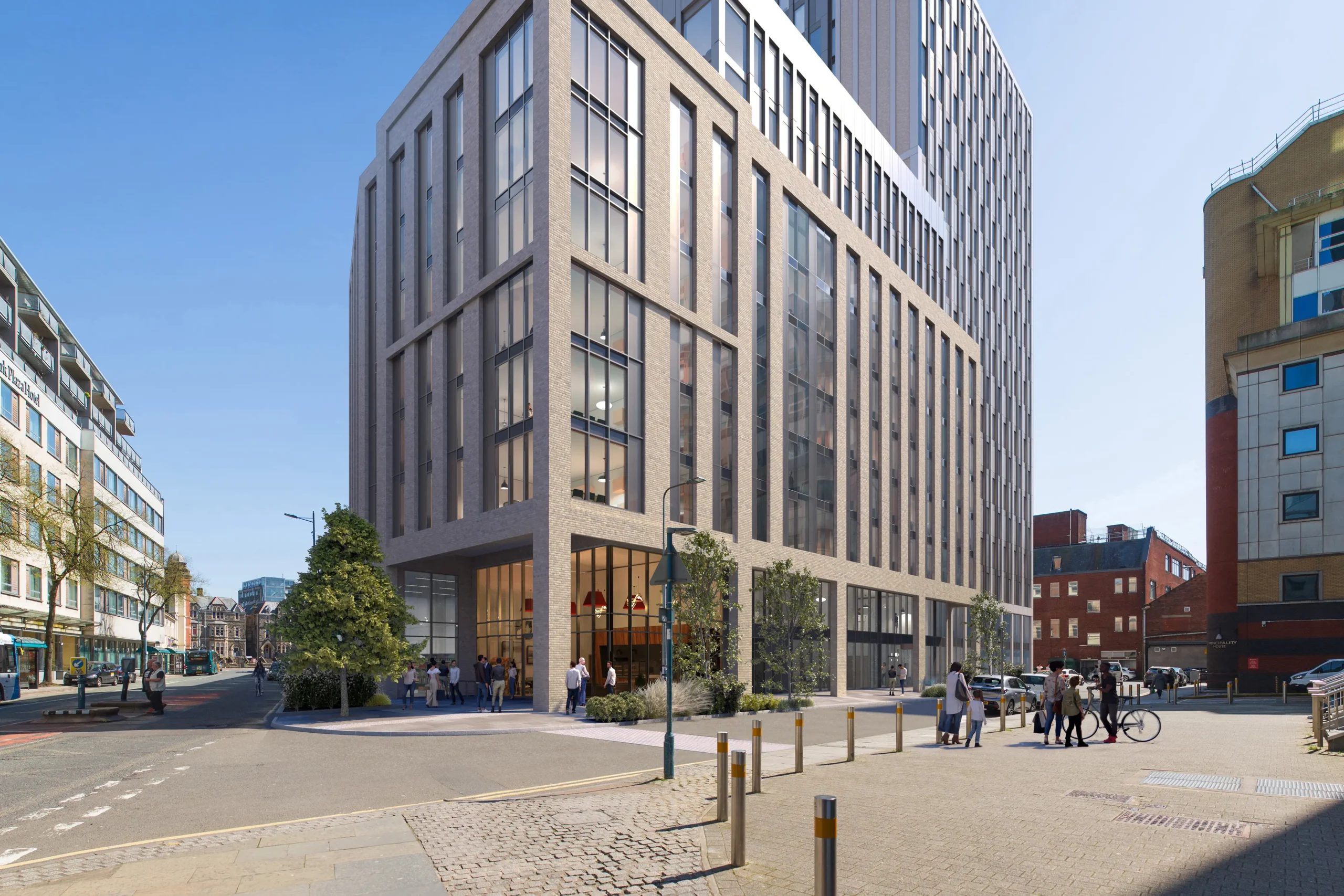
Spanning from 0 to 3, each AVR level provides varying degrees of detail tailored to meet the specific needs of diverse projects. This flexibility ensures that our visualisations align perfectly with your goals and help convey your vision with clarity and precision.
Additionally, we offer cumulative visuals that illustrate how multiple buildings within larger or adjacent developments would interact and coexist.
This approach provides a holistic view of how the built environment will evolve throughout the project’s progression giving Planning Committees the opportunity to consider the bigger picture.

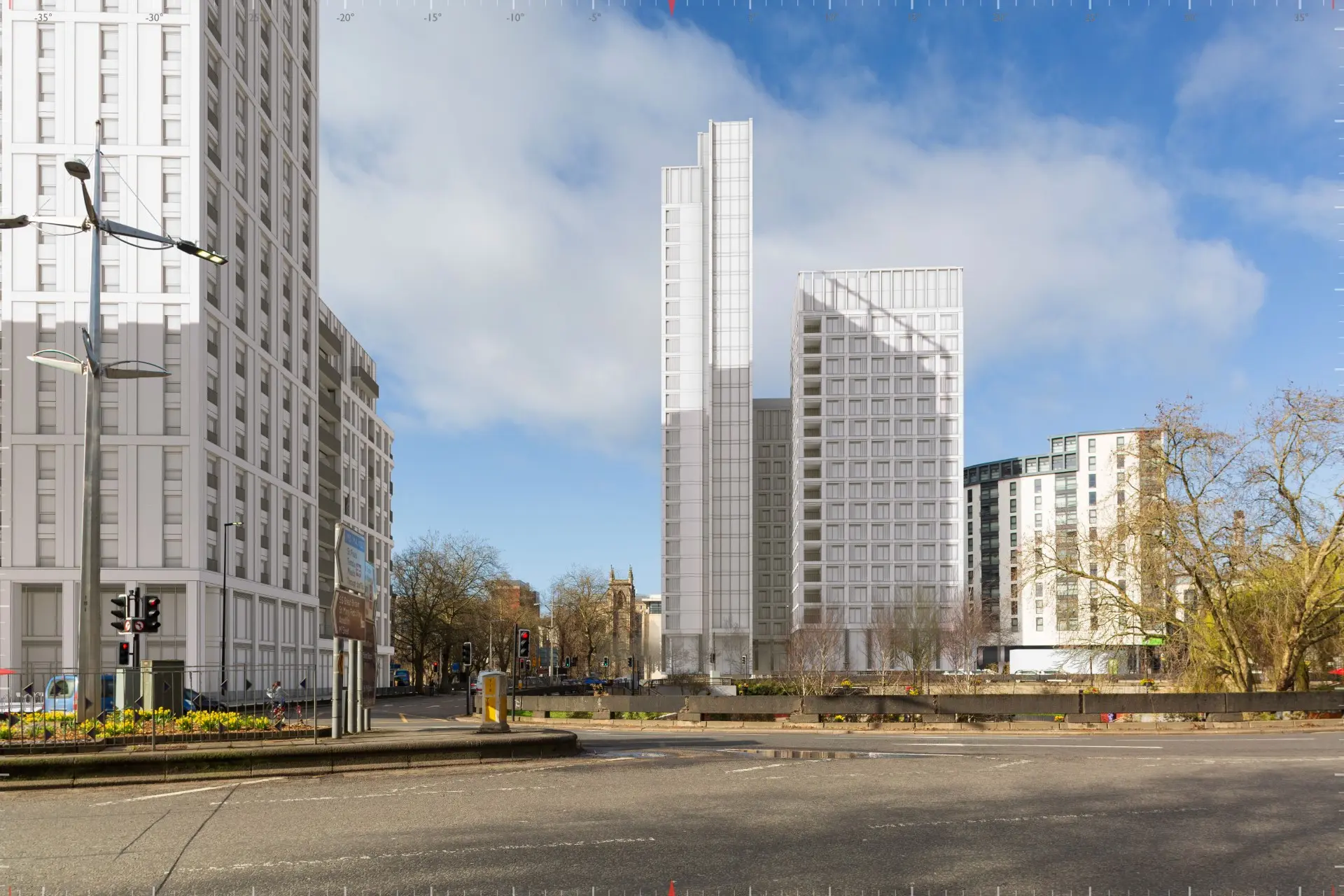
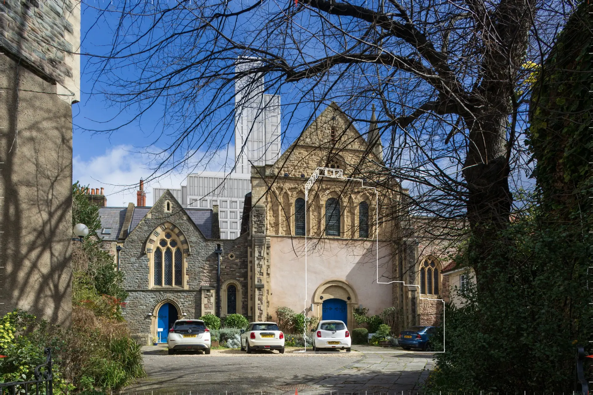
Example view demonstrating the difference between AVR2 and AVR3


Our Approach
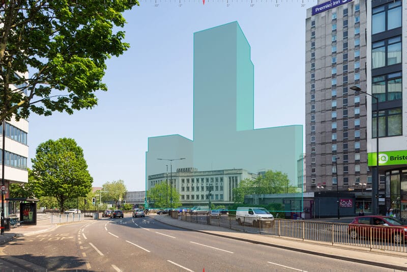
Our comprehensive visualisation process follows rigorous industry standards to ensure accuracy, reliability, and clarity. Each stage builds upon the previous, creating Verified Views that precisely represent how your development will integrate with its surroundings — from initial site photography to final planning submission.
We begin with high-resolution photography of the existing site from strategically selected (and agreed) viewpoints, capturing the current environment with precise camera positioning and equipment calibration.
Survey points are overlaid on the existing imagery, establishing accurate geographical references. This critical step ensures our visualisations maintain proper scale, perspective, and spatial relationships.
The proposed environment is meticulously modelled, creating a foundation for accurate representation. We prepare detailed 3D models based on architectural plans while ensuring all elements are properly scaled.
Your proposed development is precisely positioned within the existing context, aligning with survey points to create an accurate representation of how the proposals will appear in their real-world setting.
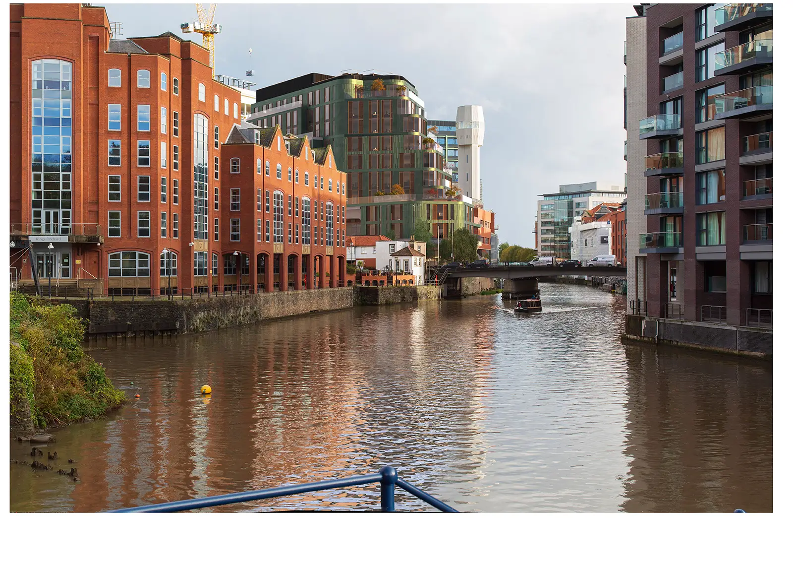
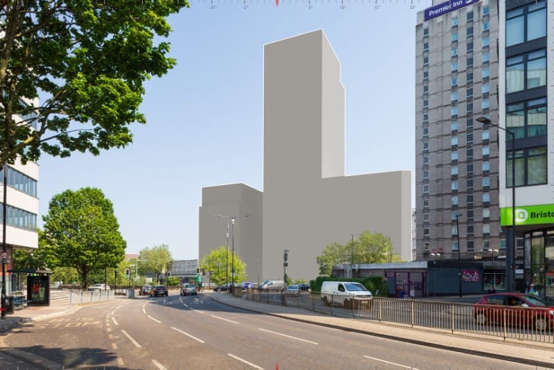
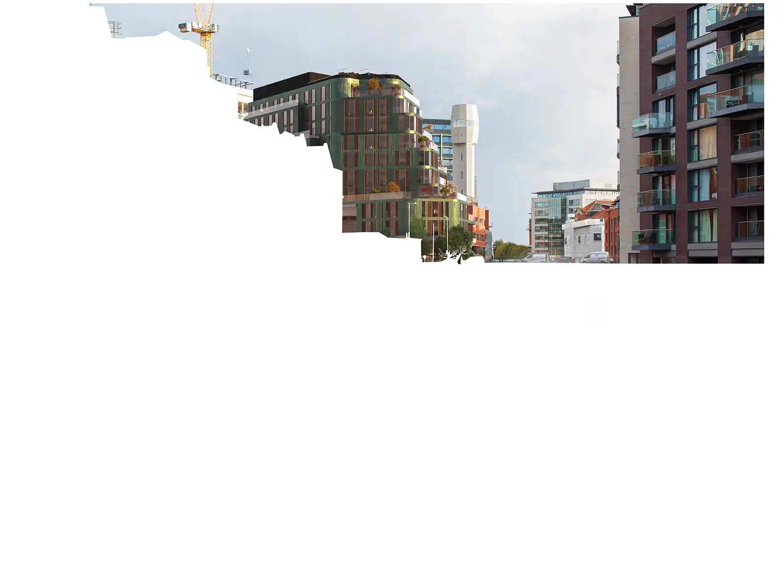
The existing photograph is carefully edited where required so that any existing elements are removed or revealed once the proposal is in place.

Foreground elements are reintroduced to create a complete view, maintaining the integrity of existing site features while showcasing how the development will interact with its immediate surroundings.
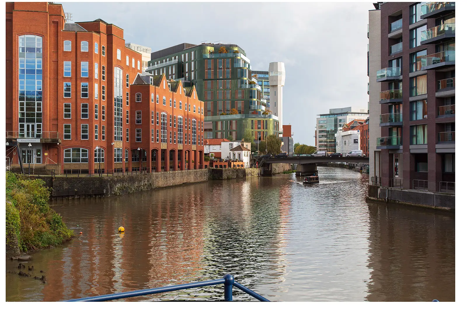
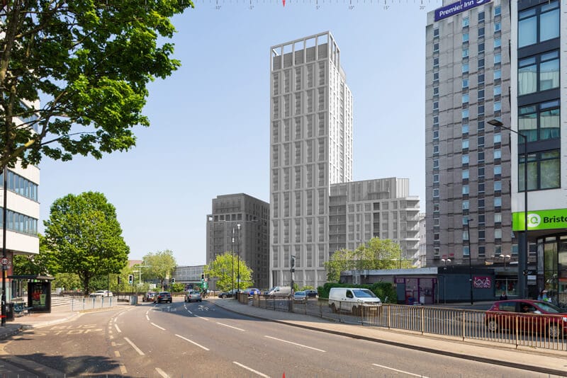
The final render undergoes a final process of refinement to elements such as reflections, shadows and highlights to further embed the proposed development into each view.
The completed visualisation undergoes rigorous quality checks to verify accuracy before being submitted as supporting documentation for planning applications, helping secure approvals through clear, precise representation.
We begin with high-resolution photography of the existing site from strategically selected (and agreed) viewpoints, capturing the current environment with precise camera positioning and equipment calibration.
Survey points are overlaid on the existing imagery, establishing accurate geographical references. This critical step ensures our visualisations maintain proper scale, perspective, and spatial relationships.
The proposed environment is meticulously modelled, creating a foundation for accurate representation. We prepare detailed 3D models based on architectural plans while ensuring all elements are properly scaled.
Your proposed development is precisely positioned within the existing context, aligning with survey points to create an accurate representation of how the proposals will appear in their real-world setting.
The existing photograph is carefully edited where required so that any existing elements are removed or revealed once the proposal is in place.
Foreground elements are reintroduced to create a complete view, maintaining the integrity of existing site features while showcasing how the development will interact with its immediate surroundings.
The final render undergoes a final process of refinement to elements such as reflections, shadows and highlights to further embed the proposed development into each view.
The completed visualisation undergoes rigorous quality checks to verify accuracy before being submitted as supporting documentation for planning applications, helping secure approvals through clear, precise representation.
UK guidance for Verified Views Montages
Our work adheres to key UK guidance and best practice for the creation of VVMs.
Third Edition of the Guidelines for Landscape and Visual Impact Assessment (GLVIA3) (2013)
This is published by the Landscape Institute and the Institute of Environmental Management & Assessment and provides a framework for assessing and illustrating visual impacts.
Landscape Institute’s Technical Guidance Note 06/19 (2019)
This outlines standards for the visual representation of development proposals.
London View Management Framework Supplementary Planning Guidance (2012)
This includes detailed specifications for Accurate Visual Representations (AVRs) in London.
Scottish Natural Heritage (SNH): Visual Representation of Wind Farms Version 2.2 (2017)
This guidance, along with SNH’s advice on assessing small-scale wind energy proposals (2016), is followed for creating accurate AVRs for wind farms and similar projects.
English Heritage: Seeing History in the View (2011)
This guidance is for understanding and assessing heritage significance within views and can be applied to any view that has significant heritage values.
Local Authority Guidance
When regulatory authorities establish their own guidelines, they often supersede the aforementioned standards, even if those guidelines are based on similar principles.

Speak to our experts
Our Verified Views Services are designed to provide accurate, reliable, and objective visualisations that can support the success of your project. Combining cutting-edge techniques with unrivalled expertise, we deliver Accurate Visual Representations (AVRs) and Verified Views that meet the highest industry standards and planning requirements.